(
W
(
W
(
W
(
W
VW-02
SMW-02
SMW-01
VW-01
1762451
.67
1765732
.5
1769013
.33
1772294
.17
1775575
1778855
.83
1782136
.67
1785417
.5
1788698
.33
1791979
.17
1795260
1798540
.83
1801821
.67
1805102
.5
1808383
.33
1811664
.17
1814945
1818225
.83
1821506
.67
1824787
.5
16144326
.67
16144326
.67
16147607
.5
16147607
.5
16150888
.33
16150888
.33
16154169
.17
16154169
.17
16157450
16157450
16160730
.83
16160730
.83
16164011
.67
16164011
.67
16167292
.5
16167292
.5
16170573
.33
16170573
.33
16173854
.17
16173854
.17
Legend
Project Area
(
(
W
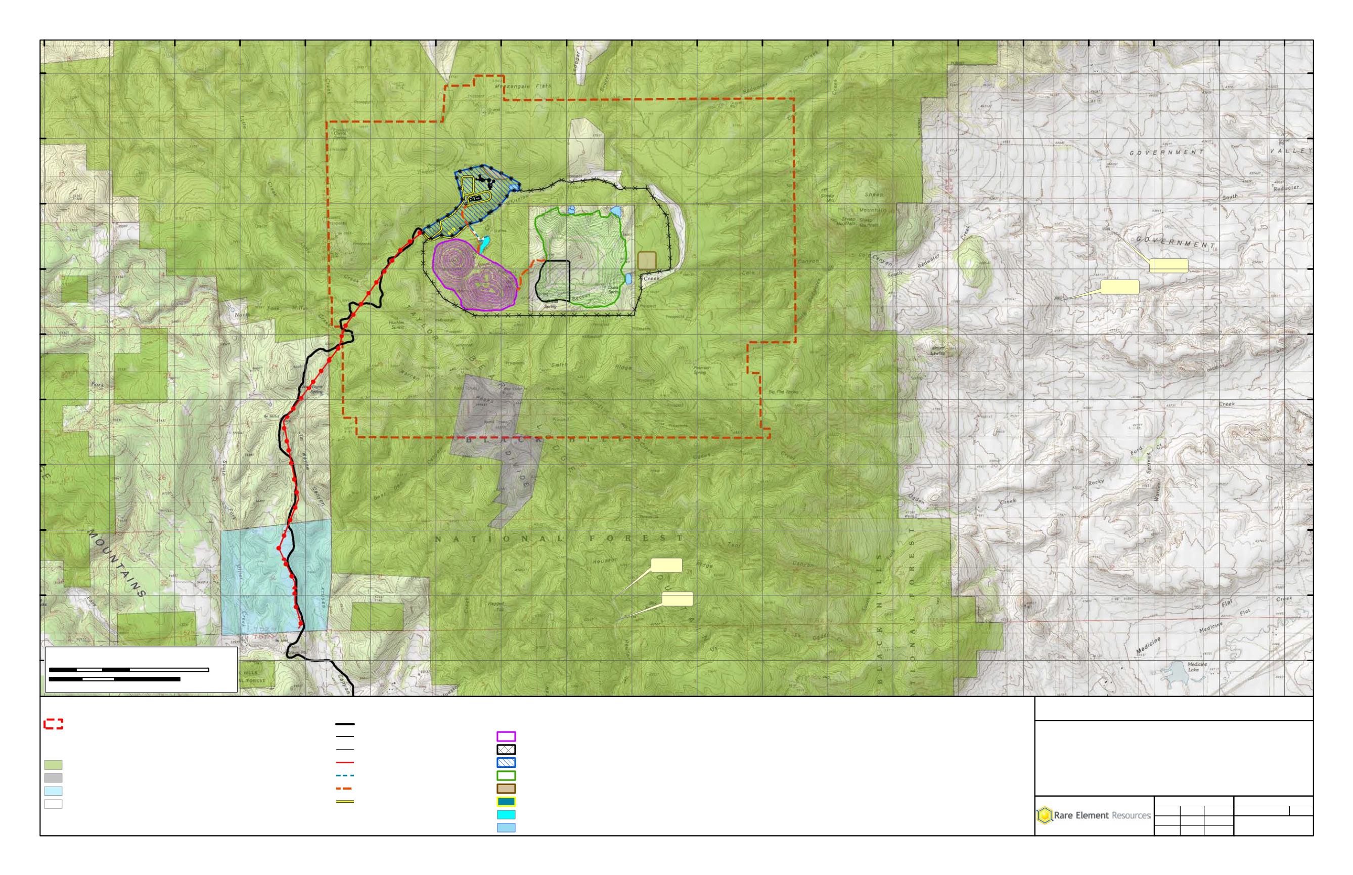
Monitoring Wells
Surface Ownership
Black Hills National Forest
Private Surface, Federal Minerals Subject to Air Force Withdrawl
State
Private
t
MAP 5.3-4
Location of Groundwater Monitoring Wells
Outside the Project Area - Bull Hill Project Area
Bear Lodge Project
Rare Element Resources, Inc.
Project
Title
Scale = 1:48,000
File No.
Rev 0
2/27/2014
Review:
Check:
GIS:
Project No. 011-10
MAB
MAB
JST
Path: M:\Rare_Element\_ArcMap\POO\Map 5.3-4.mxd
Coordinate System: NAD 1983 UTM Zone 13N Feet
0
4,000
8,000Feet
0
1
2 Kilometers
37
Proposed Bull Hill Project
Miller Creek Access Route
D D
Fence (5-Strand Barbed Wire)
k k
Fence (6 ft. Chain Link)
! !
Power Line
Water Line
Haul Road
Secondary Haul Road
Facility Footprints
Mineable Pit
Low Grade Ore Stockpile
Physical Upgrade Plant
Waste Rock Facility
Topsoil Stockpiles
Powder Magazine
Pit Dewatering Pond
Sediment Pond


