(
S
(
S
(
S
(
S
(
S
(
S
(
(
S
(
S
(
S
(
S
(
S
(
S
(
S
(
S
(
S
(
S
(
S
(
S
(
S
(
S
(
S
(
S
(
S
(
S
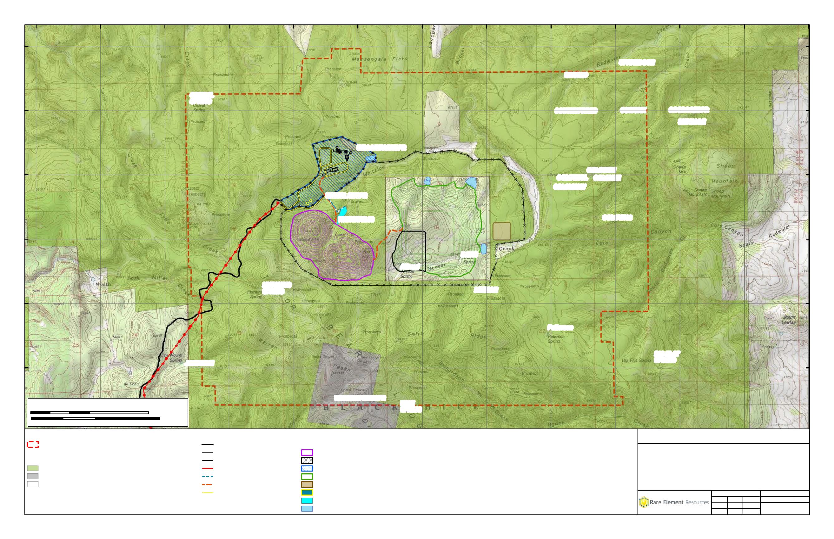
Allread
BIG FLAT
SPRING
COLCYN01
COLCYN02
COLCYNE
COLCYNOL
COLCYNSW
CORRAL SPRING
COWCRK
DAVIS
GOODSONSPR
HUTCHINS
SPRING
JIMWAYNE
LEEMAN
MINE SPRING
SHPNOSE
SOUTHUPRRED
UPRRED
UPRREDCON
WARRENPEAKSPR
WHITELAWSPR
WHITETAIL02
WILLOWPARKSPR
Petterson
1769013
.33
1772294
.17
1775575
1778855
.83
1782136
.67
1785417
.5
1788698
.33
1791979
.17
1795260
1798540
.83
1801821
.67
1805102
.5
1808383
.33
16157450
16157450
16160730
.83
16160730
.83
16164011
.67
16164011
.67
16167292
.5
16167292
.5
16170573
.33
16170573
.33
16173854
.17
16173854
.17
Legend
Project Area
(
S
Springs
Surface Ownership
Black Hills National Forest
Private Surface, Federal Minerals Subject to Air Force Withdrawl
Private
t
MAP 5.3-2
Locations of Springs and Seeps
Bull Hill Project Area
Bear Lodge Project
Rare Element Resources, Inc.
Project
Title
Scale = 1:30,000
File No.
Rev 0
2/27/2014
Review:
Check:
GIS:
Project No. 011-10
MAB
MAB
JST
Path: M:\Rare_Element\_ArcMap\POO\Map 5.3-2.mxd
Coordinate System: NAD 1983 UTM Zone 13N Feet
0
3,000
6,000Feet
0
1
2 Kilometers
35
Proposed Bull Hill Project
Miller Creek Access Route
D D
Fence (5-Strand Barbed Wire)
k k
Fence (6 ft. Chain Link)
! !
Power Line
Water Line
Haul Road
Secondary Haul Road
Facility Footprints
Mineable Pit
Low Grade Ore Stockpile
Physical Upgrade Plant
Waste Rock Facility
Topsoil Stockpiles
Powder Magazine
Pit Dewatering Pond
Sediment Pond


