^
_
^
_
^
_
^
_
^
_
^
_
^
_
^
_
^
_
^
_
^
_
^
_
^
_
^
_
^
_
^
_
T48N R65W
UMW-04
UMW-02
UMW-01
UMW-03
USMW-03
USMW-02
USMW-01
Met Station
UAMS-4
UAMS-3
UAMS-2
UAMS-1
USMW-04
UMW-05
USMW-05
UAMS-5
1723081
.67
1726362
.5
1729643
.33
1732924
.17
1736205
1739485
.83
16016374
.17
16016374
.17
16019655
16019655
16022935
.83
16022935
.83
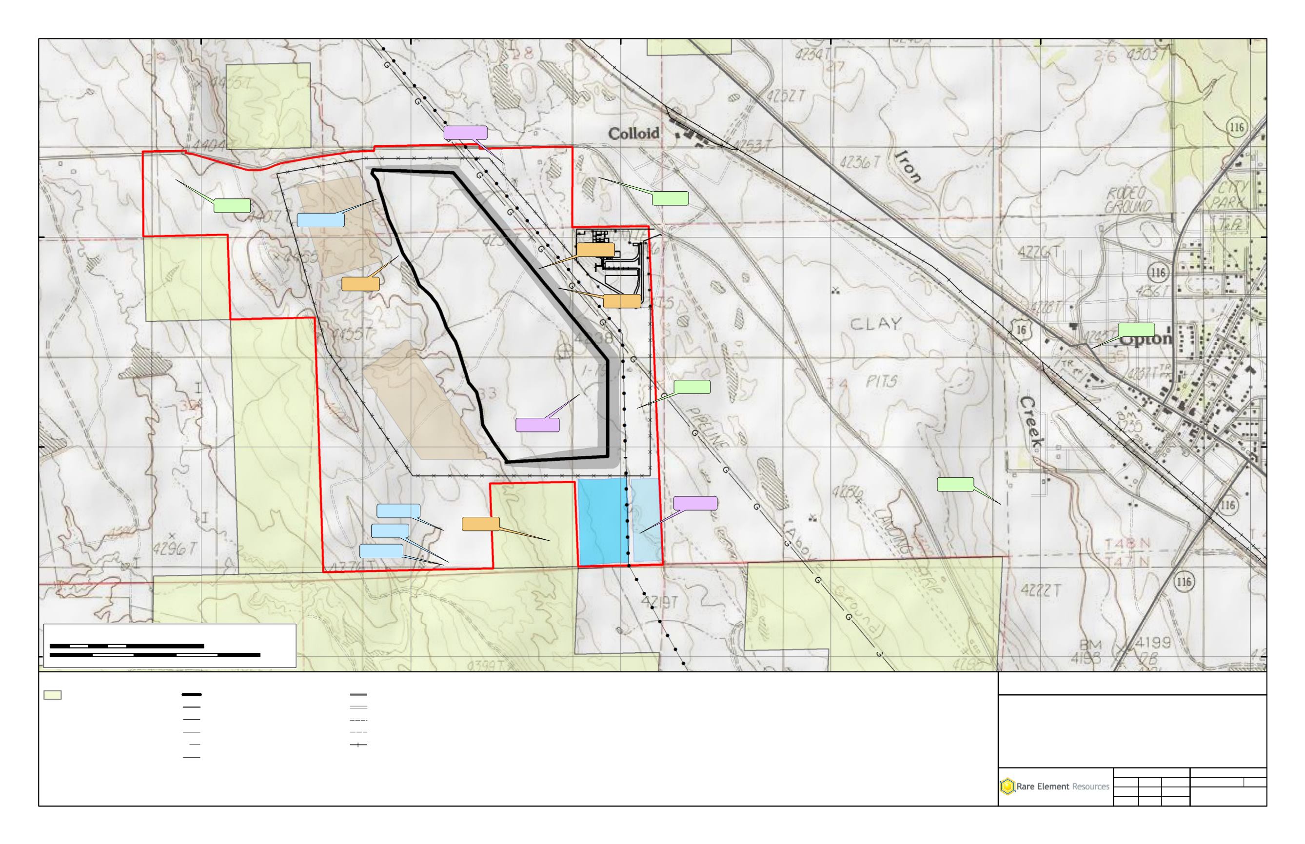
Legend
National Grassland USFS
Tailings Storage Facility Footprint
Plant
D D
Fence - Facility
k k
Fence - Plant
G
Gas Pipeline
! !
Relocated kVA Power Line
Secondary Road
Local, Rural,or City Street
Unpaved Dirt Road
Vehicle Trail (4WD)
Railroads
^
_
2013 Monitoring Well Locations
2012 Monitoring Well Locations
^
_
Air Monitoring Station
^
_
Met Station
^
_
Deep Monitoring Well
^
_
Shallow Monitoring Well
t
MAP A-2
Upton Plant
Environmental Monitoring Locations
Bear Lodge Project
Rare Element Resources, Inc.
Project
Title
Scale = 1:14,400
File No.
Rev 0
2/27/2014
2/27/2014
2/27/2014
Review:
Check:
GIS:
Project No. 011-10
MAB
MAB
JST
Path: M:\Rare_Element\_ArcMap\POO\MapA-2.mxd
Coordinate System: NAD 1983 UTM Zone 13N Feet
0
1,200
2,400Feet
0
1 Kilometers
12


